 Your clue is "under spidery roots".
Saint Ann's Hill takes its name from a chapel built around
1334 dedicated to St. Ann. It's original name was Eldebury
(Oldbury) Hill with an old fort, and there are traces of
old earthen defences on the top. You may have passed this
thickly forested hill, not far from the M3/M25 motorway
junction, and overlooking Thorpe Amusement Park - and
not given it a second glance.
This location may not be in the same league as
Hampton Court
or
Windsor Castle,
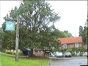
but it is still well worth a visit. The nearest pub is
"The Golden Grove" at
N 51° 23.581 W 000° 31.136
walking distance from the
road named St. Anne's Hill, signed to the nature
trail park. Free car parking is in the lane at
N 51° 23.810 W 000° 31.400
Your clue is "under spidery roots".
Saint Ann's Hill takes its name from a chapel built around
1334 dedicated to St. Ann. It's original name was Eldebury
(Oldbury) Hill with an old fort, and there are traces of
old earthen defences on the top. You may have passed this
thickly forested hill, not far from the M3/M25 motorway
junction, and overlooking Thorpe Amusement Park - and
not given it a second glance.
This location may not be in the same league as
Hampton Court
or
Windsor Castle,
but it is still well worth a visit. The nearest pub is
"The Golden Grove" at
N 51° 23.581 W 000° 31.136
walking distance from the
road named St. Anne's Hill, signed to the nature
trail park. Free car parking is in the lane at
N 51° 23.810 W 000° 31.400
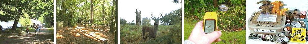
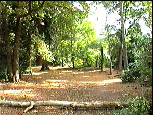
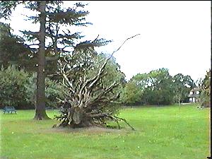 Go through the iron gates and follow the nature
trail signs. The path wind around the top of the
hill, passing a flat grass area called "The Dell"
which has several picnic tables and an impressive
upturned tree root.
Go through the iron gates and follow the nature
trail signs. The path wind around the top of the
hill, passing a flat grass area called "The Dell"
which has several picnic tables and an impressive
upturned tree root.
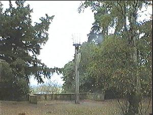 Further round the hill you will find lookout points
- bring your binoculars :-) The best is probably that
where there is a beacon, and you can see both Thorpe
Park, in the foreground, and Heathrow Airport beyond.
Sorry to disappoint you, but the beacon is not so
ancient, having been erected in the early 1980's -
to commemorate the 400th anniversary of the sighting
of The Great Armada as it approached from Spain in 1588.
You should have no problem finding the Geocache,
which is a moderate sized tupperware box,
holding
toys and
and lots of other low cost "goodies".
Further round the hill you will find lookout points
- bring your binoculars :-) The best is probably that
where there is a beacon, and you can see both Thorpe
Park, in the foreground, and Heathrow Airport beyond.
Sorry to disappoint you, but the beacon is not so
ancient, having been erected in the early 1980's -
to commemorate the 400th anniversary of the sighting
of The Great Armada as it approached from Spain in 1588.
You should have no problem finding the Geocache,
which is a moderate sized tupperware box,
holding
toys and
and lots of other low cost "goodies".

You will find more Lovelock caches on
www.gpss.co.uk/geocache
If you wish to contact Robin and want a reply,
please email him direct on gpss@compuserve.com
If you do this through a geocaching web site,
please make sure you include your email address.
Robin regrets that he may not reply to those
who seek to hide who they are. Please include
at least your name and email address.